© Yvonne Brückner, Tourismusverband Sächsische Schweiz

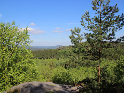
Großer Zschirnstein

At a glance

  • Start: Krippen parking lot
  • Destination: Krippen parking lot
  • Medium
  • 17,73 km
  • 5 hours 30 minutes
  • 571 m
  • 545 m
  • 125 m

This hike offers impressive views and leads to the Großer Zschirnstein.

The highest elevation in Saxon Switzerland is the Großer Zschirnstein, a slightly tilted table mountain with an excellent panoramic view. At its southern end is the "Mittagsstein," which at 562 m is the highest point of the massif. Here you can enjoy an impressive view.

Tour dashboard

Pavings

  • Unknown (1%)
  • Street (4%)
  • Tarmac (18%)
  • Gravel (17%)
  • Hiking trail (43%)
  • Path (19%)

Weather

General information

Next steps

It appears that you are using Microsoft Internet Explorer as your web browser to access our site.

For reasons of functionality and security, we recommend that you use a current web browser such as Firefox, Chrome, Safari, Opera, or Edge. Internet Explorer does not display all the content of our website correctly and does not offer all its functions.