© Tourist-Information Altenberg

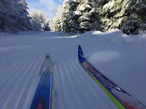
Altenberg / Waldidylle - Cross-Country ski path Waldidylle (S7)

At a glance

  • Start: Waldidylle - Waldidyller Weg Richtung Oberbärenburg (Parkplatz)
  • Destination: Waldidylle - Waldidyller Weg Richtung Oberbärenburg
  • Difficult
  • 5,68 km
  • 1 hour 30 minutes
  • 134 m
  • 725 m
  • 592 m

Cross-country ski path in the middle of pure idyll.

Diese Rundtour führt Sie von Waldidylle über den Alten Pfützenweg und Tirolerweg zurück nach Waldidylle.


Info:

Ein Skiwanderweg liegt dann vor, wenn er als Weg erkennbar und  befahrbar ist, ebenso eindeutig beschildert und in Karten ausgewiesen ist. Skiwanderwege sind in der Regel nur dann gespurt, wenn der Nutzungsbedarf sehr groß ist und der Betreiber die Möglichkeit dazu hat. Der Besucher hat keinen Anspruch darauf.

Tour dashboard

Pavings

  • Unknown (9%)
  • Street (1%)
  • Tarmac (20%)
  • Gravel (11%)
  • Hiking trail (68%)

Weather

General information

Next steps

It appears that you are using Microsoft Internet Explorer as your web browser to access our site.

For reasons of functionality and security, we recommend that you use a current web browser such as Firefox, Chrome, Safari, Opera, or Edge. Internet Explorer does not display all the content of our website correctly and does not offer all its functions.